ePAYS, short for electronic Pay As You Sail, is a service provided by Radio Holland. It grants users access to digital UKHO charts, AVCS, for seamless passage planning, either as a standalone solution or integrated into the Radio Holland ePlanner. What sets ePAYS apart is its flexibility and cost-effectiveness – users only pay for the charts they effectively use. This streamlined approach ensures efficient navigation without unnecessary expenses.
How does it work?
The activation of a unique coded license facilitates mariners in planning their passage. Subsequently, these plans, accompanied by relevant charts, are uploaded to the ECDIS. This digital platform acts as their navigational hub, displaying real-time data and ensuring accurate course plotting.
Dynamic Replanning and Always-Available Charts
Unforeseen passage plan changes are easy adoptable, the replanned route charts are directly available. The beauty and simplicity of ePAYS lies in its always-available principle: all relevant charts remain accessible, regardless of mid-voyage adjustments.
Promotional benefit
During the active license period with Radio Holland, the supply of the SkyWave IDP 690 antenna is offered for free, ex. shipping charges. Upon the expiration of the license, users have the option to purchase the antenna at the specified price or return it to Radio Holland, excluding shipping costs, Delivery at Terminal (D.A.T.).
Billing Efficiency
ePAYS streamlines billing, only charts effectively used are subject to invoicing. After a chart is consumed, it remains available for the entire license period. Mariners can refer back to historical data or reuse charts when required.
The pricing structure only consists of a license fee for a 12-month period, alongside charges for used charts.
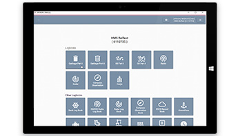
ePlanner
ePAYS is a standalone module of Radio Holland’s ePlanner, the advanced marine data system designed for voyage planning, navigation, and monitoring. As a component of e-Navigation, ePlanner equips mariners with extensive charting tools, allowing the overlay of charts with points, lines, areas, annotations, and routes. It facilitates seamless route exchange with Electronic Chart Display and Information Systems (ECDIS), incorporating automatically generated routes and integrated routing based on a vast global port database.
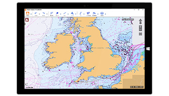
ePlanner simplifies Chart Management, enabling the purchase, download, and usage of Electronic Navigational Charts (ENC) while generating standards compliant with S-57 exchange sets for efficient ECDIS updates. Tides and Radio Signals data from ADMIRALTY Digital Products seamlessly overlay the chart, providing enhanced navigational insights. Additionally, ePlanner ensures thorough Route Monitoring through GPS and AIS inputs, offering a helming display, Estimated Time of Arrival (ETA), and other essential parameters for comprehensive navigation oversight.
In essence, ePlanner is the indispensable tool, integrating cutting-edge features to enhance the efficiency and precision of customers maritime operations.

Find out more?
Contact one of our specialists for more information or a quotation!